Map to KATAHDIN LODGE in Maine
KATAHDIN
LODGE
SNOWMOBILE
TRAIL SYSTEM
HALE POND
KATAHDIN LODGE is 1 1/2 hours driving time north of Bangor, Maine International Airport via I-95.
Take exit #264 and then proceed north on Maine State Rt. #11 for 19 miles to get to the Lodge.
GPS coordinates are LATITUDE 46.1330548175317 and LONGITUDE -68.381781578064.
elevation
1000 ft.
elevation
2440 ft.
MT.
CHASE
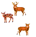
When driving in Maine, always be on cautious lookout for moose and deer standing or darting in the roadway , especially during June, October, November, and December!
OWLSBOROUGH RD
BAXTER
STATE
PARK
22 MILES
INTERNATIONAL APPALACHIAN TRAIL
MILE MARKER 10
MOUNTAIN RD